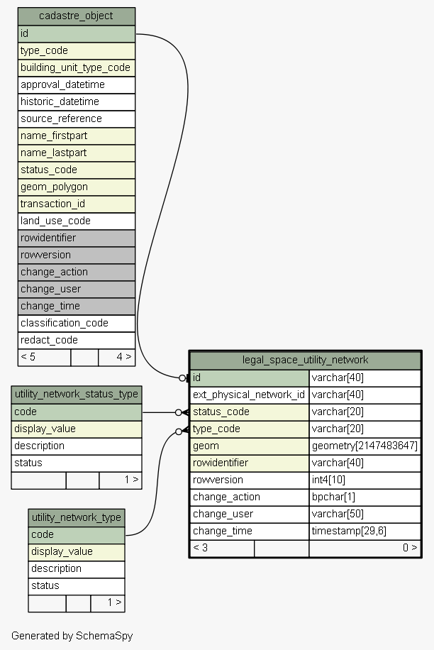
| Table sola.cadastre.legal_space_utility_network LADM Defintion: A utility network concerns legal space, which does not necessarily coincide with the physical space of a utility network. Implementation of the LADM LA_LegalSpaceUtilityNetwork class. Not used by SOLA. Tags: LADM Reference Object, Change History, Not Used
|
Generated by SchemaSpy |
| |||||||||||||||||||||||||||||||||||||||||||||||||||||||||||||||||||||||||||||||||||||||||||||||||||||||||
Analyzed at Tue May 31 09:57 NZST 2016 | |||||||||||||||||||||||||||||||||||||||||||||||||||||||||||||||||||||||||||||||||||||||||||||||||||||||||
Indexes:
| Column(s) | Type | Sort | Constraint Name |
|---|---|---|---|
| id | Primary key | Asc | legal_space_utility_network_pkey |
| id | Performance | Asc | legal_space_utility_network_id_fk94_ind |
| geom | Performance | Asc | legal_space_utility_network_index_on_geom |
| rowidentifier | Performance | Asc | legal_space_utility_network_index_on_rowidentifier |
| status_code | Performance | Asc | legal_space_utility_network_status_code_fk95_ind |
| type_code | Performance | Asc | legal_space_utility_network_type_code_fk96_ind |
|
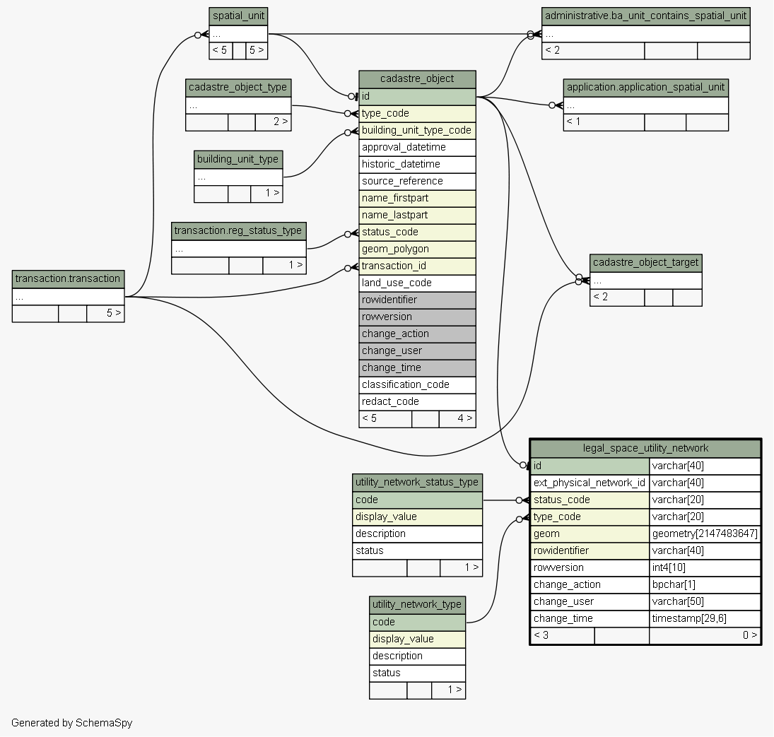
Excluded from diagram's relationships: cadastre_object.rowidentifier spatial_unit_group.change_action spatial_value_area.rowidentifier level.change_time cadastre_object_node_target.rowversion spatial_unit_address.change_action survey_point.rowidentifier spatial_unit_address.change_user survey_point.change_time spatial_unit_group.rowversion spatial_value_area.change_time spatial_unit_in_group.change_action level.change_user spatial_unit_in_group.rowidentifier cadastre_object_node_target.rowidentifier cadastre_object_target.change_time cadastre_object.change_user spatial_unit.rowidentifier cadastre_object_node_target.change_time spatial_unit_in_group.rowversion survey_point.change_action cadastre_object_node_target.change_user cadastre_object.change_time spatial_unit.change_user spatial_unit_group.rowidentifier survey_point.change_user spatial_unit_in_group.change_time spatial_unit.change_time level.rowversion level.change_action cadastre_object.change_action survey_point.rowversion spatial_unit_group.change_user spatial_value_area.change_action spatial_unit.change_action cadastre_object_target.change_user spatial_unit_group.change_time spatial_unit_address.change_time cadastre_object_target.rowversion spatial_value_area.rowversion spatial_value_area.change_user cadastre_object_target.rowidentifier spatial_unit.rowversion cadastre_object.rowversion spatial_unit_in_group.change_user cadastre_object_target.change_action level.rowidentifier spatial_unit_address.rowversion spatial_unit_address.rowidentifier cadastre_object_node_target.change_action