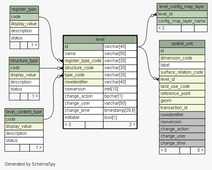
| Table sola.cadastre.level LADM Definition: A set of spatial units, with geometric, and/or topological, and/or thematic coherence. EXAMPLE 1 - One level for an urban cadastre and another level for a rural cadastre. EXAMPLE 2 - One level with rights and another with restrictions. EXAMPLE 3 - One level with formal rights, a second level with informal rights and a third level with customary rights. EXAMPLE 4 - One level with point based spaital units, a second level with line based spatial units, and a third level with polygon based spatial features. Implementation of the LADM LA_Level class. Used by SOLA to identify the set of spatial features for each layer displayed in the Map Viewer. Tags: Reference Table, LADM Reference Object, Change History
|
Generated by SchemaSpy |
| ||||||||||||||||||||||||||||||||||||||||||||||||||||||||||||||||||||||||||||||||||||||||||||||||||||||||||||||||||||||
Analyzed at Tue May 31 09:57 NZST 2016 | ||||||||||||||||||||||||||||||||||||||||||||||||||||||||||||||||||||||||||||||||||||||||||||||||||||||||||||||||||||||
Indexes:
| Column(s) | Type | Sort | Constraint Name |
|---|---|---|---|
| id | Primary key | Asc | level_pkey |
| rowidentifier | Performance | Asc | level_index_on_rowidentifier |
| register_type_code | Performance | Asc | level_register_type_code_fk58_ind |
| structure_code | Performance | Asc | level_structure_code_fk59_ind |
| type_code | Performance | Asc | level_type_code_fk60_ind |
|
Excluded from diagram's relationships: cadastre_object.rowidentifier spatial_unit_group.change_action spatial_value_area.rowidentifier cadastre_object_node_target.rowversion spatial_unit_address.change_action survey_point.rowidentifier spatial_unit_address.change_user survey_point.change_time spatial_unit_group.rowversion spatial_value_area.change_time spatial_unit_in_group.change_action legal_space_utility_network.change_user spatial_unit_in_group.rowidentifier cadastre_object_node_target.rowidentifier cadastre_object_target.change_time legal_space_utility_network.change_time cadastre_object.change_user spatial_unit.rowidentifier legal_space_utility_network.rowversion cadastre_object_node_target.change_time spatial_unit_in_group.rowversion survey_point.change_action cadastre_object_node_target.change_user cadastre_object.change_time spatial_unit.change_user spatial_unit_group.rowidentifier survey_point.change_user spatial_unit_in_group.change_time spatial_unit.change_time cadastre_object.change_action survey_point.rowversion legal_space_utility_network.change_action spatial_unit_group.change_user spatial_value_area.change_action spatial_unit.change_action cadastre_object_target.change_user spatial_unit_group.change_time spatial_unit_address.change_time cadastre_object_target.rowversion spatial_value_area.rowversion spatial_value_area.change_user cadastre_object_target.rowidentifier spatial_unit.rowversion legal_space_utility_network.rowidentifier cadastre_object.rowversion spatial_unit_in_group.change_user cadastre_object_target.change_action spatial_unit_address.rowversion spatial_unit_address.rowidentifier cadastre_object_node_target.change_action