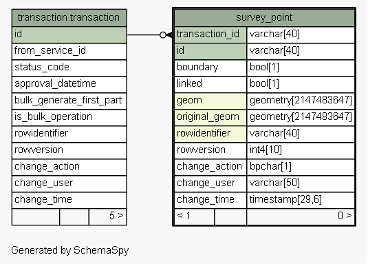
| Table sola.cadastre.survey_point Used to store new survey point details (i.e. boundary and traverse) when capturing a survey plan into SOLA. Survey points can be used to define new cadastre objects. Tags: FLOSS SOLA Extension, Change History
|
Generated by SchemaSpy |
| ||||||||||||||||||||||||||||||||||||||||||||||||||||||||||||||||||||||||||||||||||||||||||||||||||||||||||||||
Analyzed at Tue May 31 09:57 NZST 2016 | ||||||||||||||||||||||||||||||||||||||||||||||||||||||||||||||||||||||||||||||||||||||||||||||||||||||||||||||
Indexes:
| Column(s) | Type | Sort | Constraint Name |
|---|---|---|---|
| transaction_id + id | Primary key | Asc/Asc | survey_point_pkey |
| geom | Performance | Asc | survey_point_index_on_geom |
| original_geom | Performance | Asc | survey_point_index_on_original_geom |
| rowidentifier | Performance | Asc | survey_point_index_on_rowidentifier |
| transaction_id | Performance | Asc | survey_point_transaction_id_fk99_ind |
|
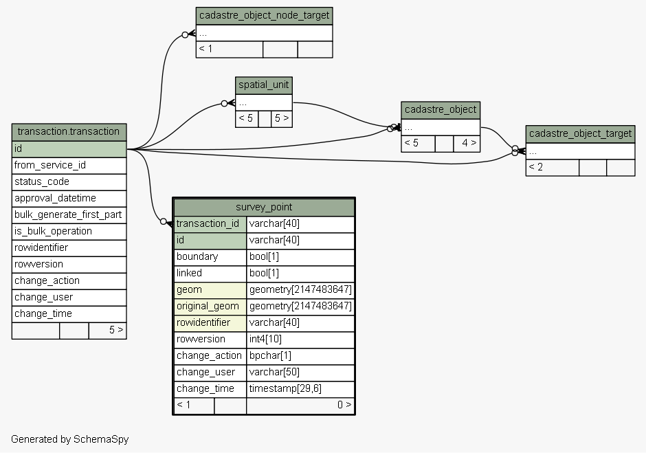
Excluded from diagram's relationships: cadastre_object.rowidentifier spatial_unit_group.change_action spatial_value_area.rowidentifier level.change_time cadastre_object_node_target.rowversion spatial_unit_address.change_action spatial_unit_address.change_user spatial_unit_group.rowversion spatial_value_area.change_time spatial_unit_in_group.change_action level.change_user legal_space_utility_network.change_user spatial_unit_in_group.rowidentifier cadastre_object_node_target.rowidentifier cadastre_object_target.change_time legal_space_utility_network.change_time cadastre_object.change_user spatial_unit.rowidentifier legal_space_utility_network.rowversion cadastre_object_node_target.change_time spatial_unit_in_group.rowversion cadastre_object_node_target.change_user cadastre_object.change_time spatial_unit.change_user spatial_unit_group.rowidentifier spatial_unit_in_group.change_time spatial_unit.change_time level.rowversion level.change_action cadastre_object.change_action legal_space_utility_network.change_action spatial_unit_group.change_user spatial_value_area.change_action spatial_unit.change_action cadastre_object_target.change_user spatial_unit_group.change_time spatial_unit_address.change_time cadastre_object_target.rowversion spatial_value_area.rowversion spatial_value_area.change_user cadastre_object_target.rowidentifier spatial_unit.rowversion legal_space_utility_network.rowidentifier cadastre_object.rowversion spatial_unit_in_group.change_user cadastre_object_target.change_action level.rowidentifier spatial_unit_address.rowversion spatial_unit_address.rowidentifier cadastre_object_node_target.change_action