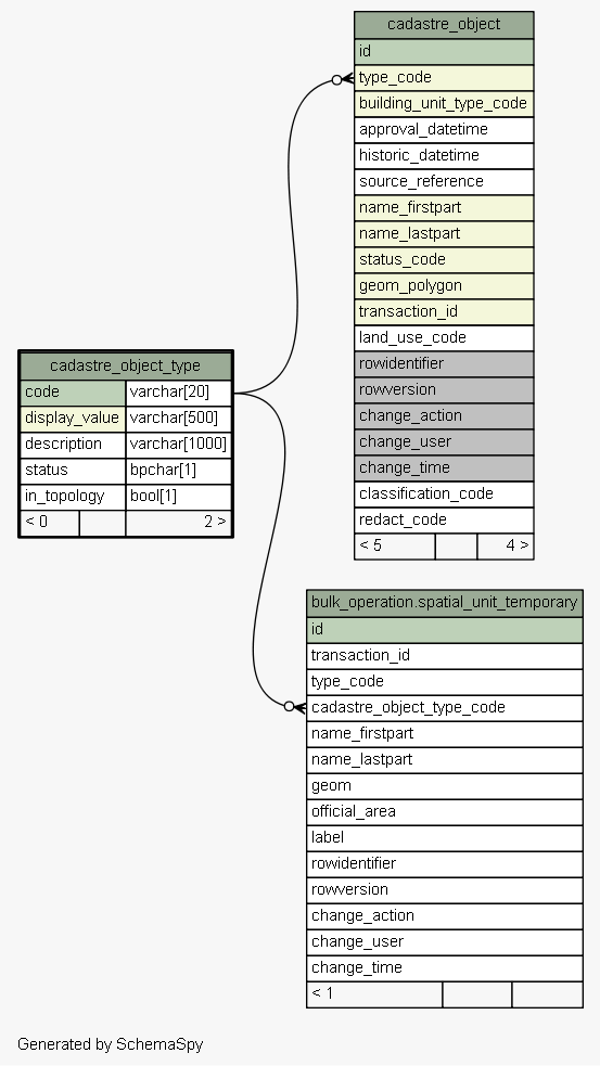
| Table sola.cadastre.cadastre_object_type Code list of cadastre object types. E.g. parcel, building_unit, road, etc. Tags: FLOSS SOLA Extension, Reference Table
|
Generated by SchemaSpy |
| ||||||||||||||||||||||||||||||||||||||||||||||||||||||||||
Analyzed at Tue May 31 09:57 NZST 2016 | ||||||||||||||||||||||||||||||||||||||||||||||||||||||||||
Indexes:
| Column(s) | Type | Sort | Constraint Name |
|---|---|---|---|
| code | Primary key | Asc | cadastre_object_type_pkey |
| display_value | Must be unique | Asc | cadastre_object_type_display_value_unique |
|
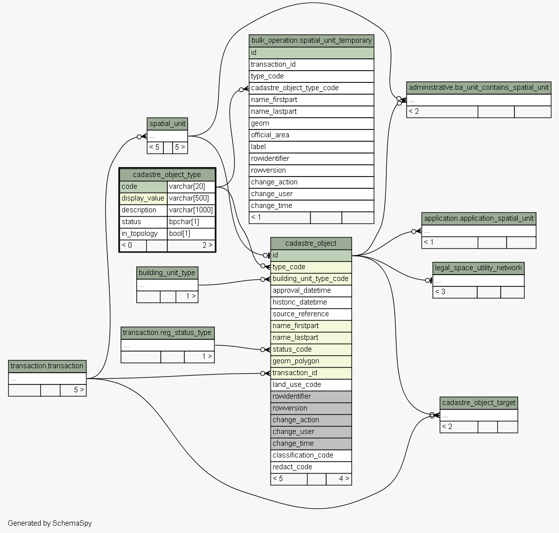
Excluded from diagram's relationships: cadastre_object.rowidentifier spatial_unit_group.change_action spatial_value_area.rowidentifier level.change_time cadastre_object_node_target.rowversion spatial_unit_address.change_action survey_point.rowidentifier spatial_unit_address.change_user survey_point.change_time spatial_unit_group.rowversion spatial_value_area.change_time spatial_unit_in_group.change_action level.change_user legal_space_utility_network.change_user spatial_unit_in_group.rowidentifier cadastre_object_node_target.rowidentifier cadastre_object_target.change_time legal_space_utility_network.change_time cadastre_object.change_user spatial_unit.rowidentifier legal_space_utility_network.rowversion cadastre_object_node_target.change_time spatial_unit_in_group.rowversion survey_point.change_action cadastre_object_node_target.change_user cadastre_object.change_time spatial_unit.change_user spatial_unit_group.rowidentifier survey_point.change_user spatial_unit_in_group.change_time spatial_unit.change_time level.rowversion level.change_action cadastre_object.change_action survey_point.rowversion legal_space_utility_network.change_action spatial_unit_group.change_user spatial_value_area.change_action spatial_unit.change_action cadastre_object_target.change_user spatial_unit_group.change_time spatial_unit_address.change_time cadastre_object_target.rowversion spatial_value_area.rowversion spatial_value_area.change_user cadastre_object_target.rowidentifier spatial_unit.rowversion legal_space_utility_network.rowidentifier cadastre_object.rowversion spatial_unit_in_group.change_user cadastre_object_target.change_action level.rowidentifier spatial_unit_address.rowversion spatial_unit_address.rowidentifier cadastre_object_node_target.change_action